Half Day Hike at Arikok National Park & Snorkel
Park pass includedTransport includedSnorkel gear
From $115 per person
Fourteen things about Arikok National Park that surprise people who have already been. Read them before you go and you will spend the day looking at different things.
Thirty-four square kilometres, on an island of about 180. Very few countries protect that share of their own territory, and Aruba did it in 2000.
The cascabel, Crotalus unicolor, is found only on Aruba. It is critically endangered, estimates of the wild population run in the low hundreds, and the Aruba Conservation Foundation runs a monitoring programme for it with local and international researchers. You will almost certainly not see one, and if you stay on the paths you will not go looking.
The lora, the yellow-shouldered Amazon, had gone locally extinct on Aruba. It was reintroduced in 2024. That is recent enough that most guidebooks have not caught up, and it is one of the few conservation stories on this island with a clean result.
More than twenty quartz veins run through the park's oldest rock formation and they were mined for gold in the nineteenth century. The ruined smelter at Bushiribana, just outside the boundary, is what is left of the 1824 rush.
The shoco is a burrowing owl. Unlike almost every other owl it does not use trees: it nests in sand banks and old termite mounds, it is active at dawn and dusk, and it is the national symbol of Aruba. It is also endangered. The wildlife page has where to look.
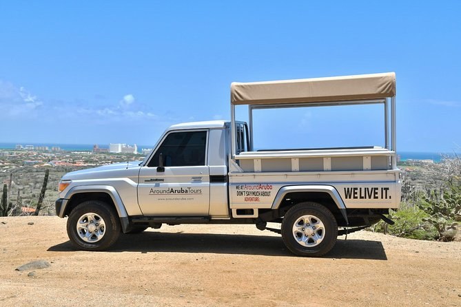
Fundacion Parke Nacional Aruba banned ATVs from the park on 1 June 2020 and UTVs on 31 October the same year, on the strength of a 2019–20 environmental impact survey of off-road damage. It is why every UTV product on the island either stays outside the boundary or transfers its riders into a jeep at the gate. The UTV page explains what that means for a booking.
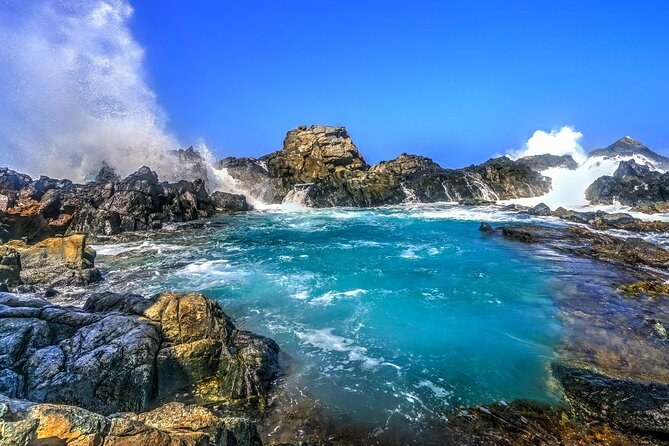
The Natural Pool sits in pillow lava — the bulbous formation lava takes when it cools under the sea. That rock is part of the Aruba Lava Formation, the oldest of the island's three, and it was on the seabed long before there was an island above it.
Caquetío drawings in Fontein Cave predate European contact in 1499. They are painted rather than carved, in an iron-rich earth pigment, and nobody publishes a confident reading of what they depict. The caves page has the detail.
The conservation pass is US$22 for adults and free for children under 17. A family of two adults and three children pays for two. That is unusually generous by Caribbean standards, and the fees page sets out the rest.
Jamanota, 188 metres. From the top you can see both coasts of the island at once, which tells you how narrow Aruba actually is. You can drive most of the way up or walk it in about an hour, and either way you should do it early.
The divi-divi and the kwihi grow permanently bent toward the south-west, shaped by a trade wind that essentially never stops. They are a compass: on this island the trees point away from the windward coast.
San Fuego runs 8:00am to 3:30pm and Vader Piet 8:30am to 3:00pm, and they are twelve kilometres apart by road. Choosing the wrong one is the commonest navigational mistake here. The map page covers which to use.
Boca Prins, Dos Playa and the northern coves face the open Atlantic with no reef in front of them, and the currents run hard along the shore. The park's swimmable water is Conchi, and only when the sea allows it. The beaches page is blunt about which is which.
The cadushi, the tall candelabra column that gives the interior its silhouette, has fruit that was eaten and wood that was used for fencing. Guides on the walking tours point out which ones and, on at least one listing, hand them round.
Aruba is not a volcanic island in the sense the rest of the Lesser Antilles are. It sits on the edge of the South American continental shelf, outside the hurricane belt, in the dry rain shadow of the trade winds. That combination — continental rock, no hurricanes, almost no rain — is what produced a Caribbean island with cactus instead of rainforest, and a national park that looks more like Baja than Barbados.
The three rock formations underneath it were laid down in order: the Aruba Lava Formation first, on an ancient seabed, then the Aruba Batholith intruding through it, then the limestone terraces built up on top as the sea level fell. Walk from the interior to the coast on any of the routes on the trails guide and you cross all three inside an hour.
The rules on the board at the entrance are short and unusually specific, and two of them surprise people. No rock stacking — the cairns visitors leave move the substrate that lizards and ground-nesting birds use. No metal detectors and no geological extraction, which is a live rule in a park with gold veins under it. No drones, anywhere, at any time. Fines are set out on the same board.
The third is the quiet one: stay on the roads. Off-road driving is what got quad bikes and side-by-sides banned in 2020, and it is why the tracks that remain are still passable. The visiting page covers what else to know before the gate.
Figures from the Aruba Conservation Foundation, published research and the park's own signage.
| Fact | The number |
|---|---|
| Area of the park | 34 square kilometres |
| Share of Aruba | Close to a fifth |
| Established | 2000 |
| Highest point | Jamanota, 188 m |
| Conservation pass, adult | US$22 |
| Conservation pass, under 17 | Free |
| Gold-bearing quartz veins | More than twenty |
| ATVs banned | 1 June 2020 |
| UTVs banned | 31 October 2020 |
| Parrot reintroduced | 2024 |
| Steps down to Conchi | About 93 |
| Speed limit inside the boundary | 20 km/h |
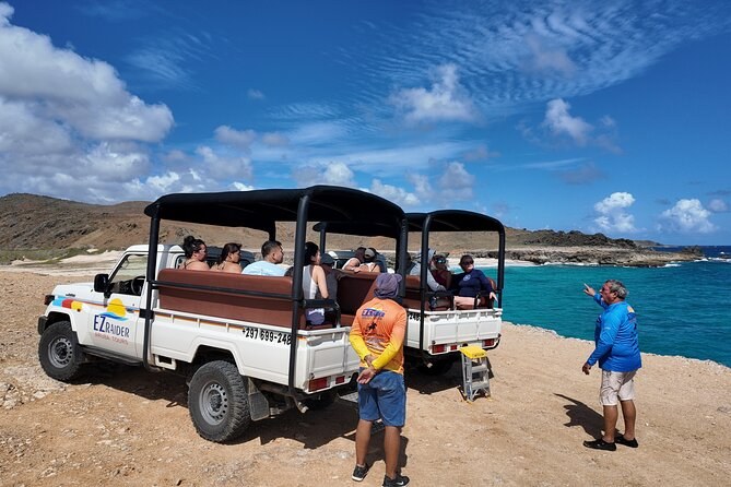
Most of these are things you can go and look at yourself rather than facts to keep in a pocket. You can stand under the drawings at Fontein, you can put your hand on pillow lava at Conchi, and you can find the burrowing owls if you are inside the gate early enough. The one you cannot reach on your own is Conchi, which is why the jeeps exist.
If any of that made you want to stand in it, the things-to-do page puts the park in the order a first visit should take, and the visiting page covers what you need in the car before you set off.
The park rewards knowing what you are looking at before you arrive. Every departure is on Arikok National Park Tours.
From $115 per person
From $121 per person